MISSISSIPPI SWIMMING HOLES |
|---|
Click here to see the home page and learn about swimming holes in other states
| See a SLIDESHOW of swimming hole photos in this state. |
This swimming hole listing is by www.swimmingholes.org
|
TOWNS | HATTIESBURG, BROOKLYN |
STATE | MS |
WATER | Black Creek |
TYPE | Creek |
DESCRIPTION | Cool, shady Black Creek (a National Scenic River) winds through Desoto National Forest south of Hattiesburg. There are swimming holes, canoe landings and canoe outfitters in the area. The Black Creek Trail parallels the creek for many miles. Info about the trail , More on the trail. For details, see DIRECTIONS below. |
AREAS | Desoto N. F. |
SANCTION | Unofficial |
FEE | No |
FACILITIES |
Unknown |
ACTIVITIES |
Swimming, Canoeing |
PHONE | Unknown |
CAMPING | Camping at sites in the N. F. |
BATHING SUITS | Unknown |
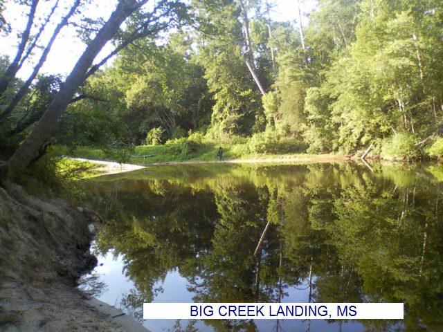
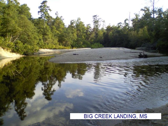
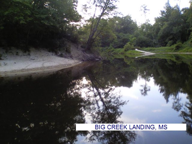
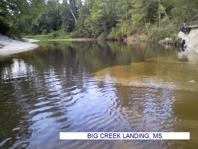
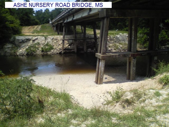
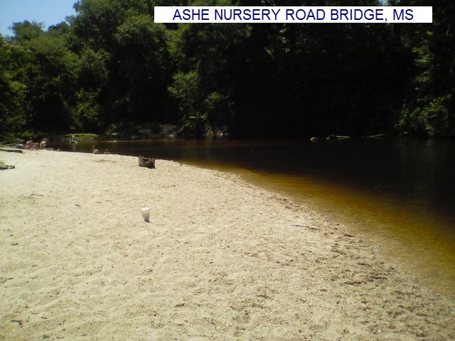
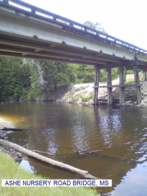
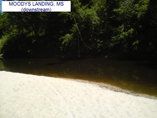
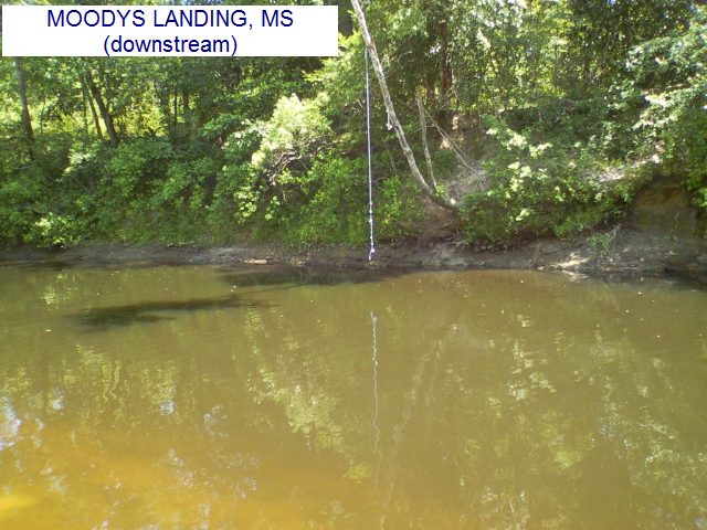
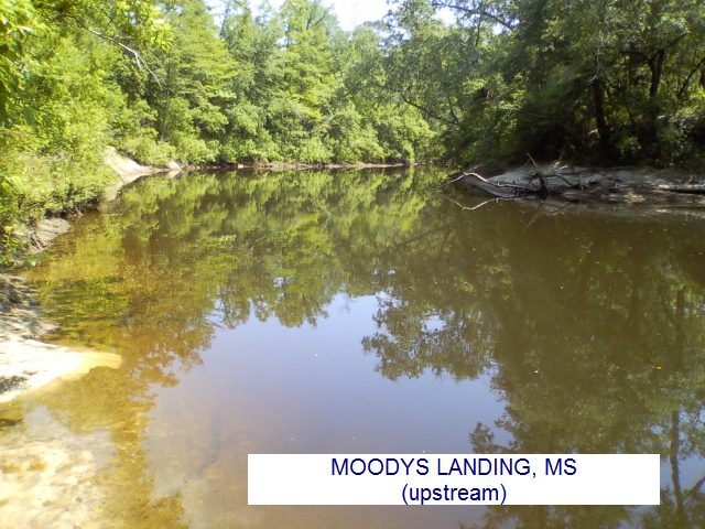
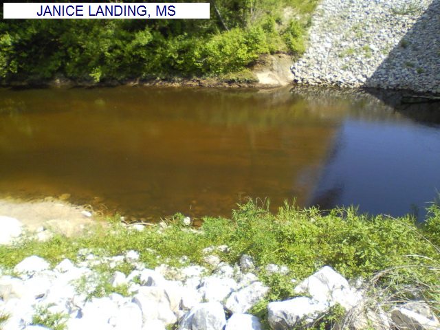
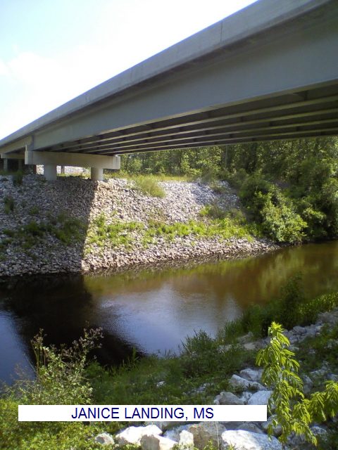
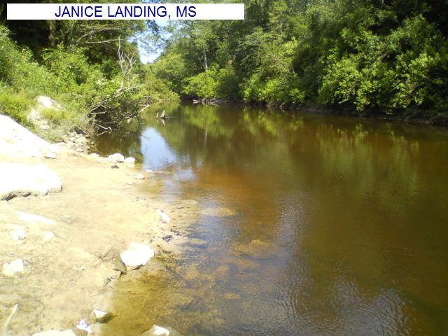
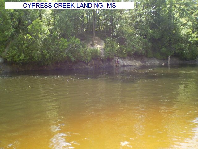
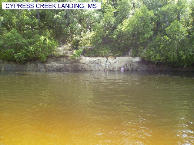
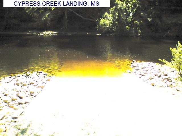
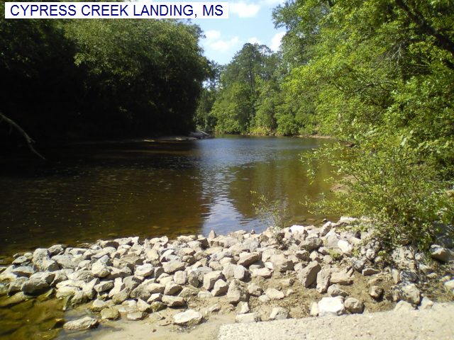
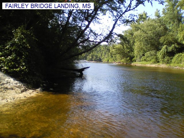
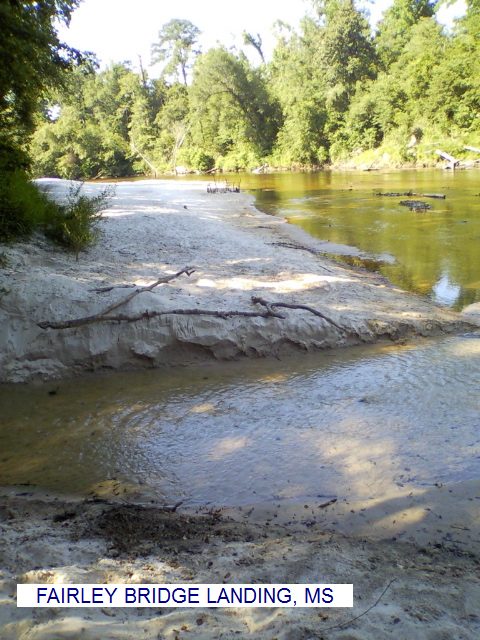
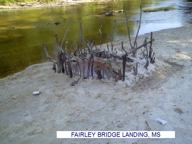
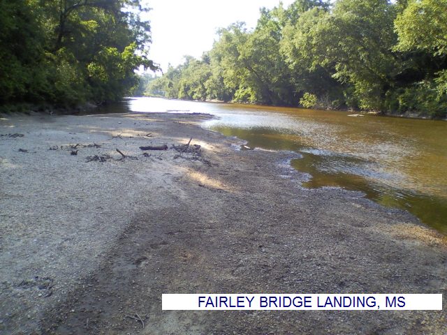
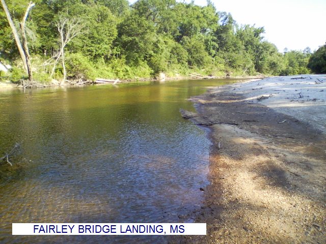
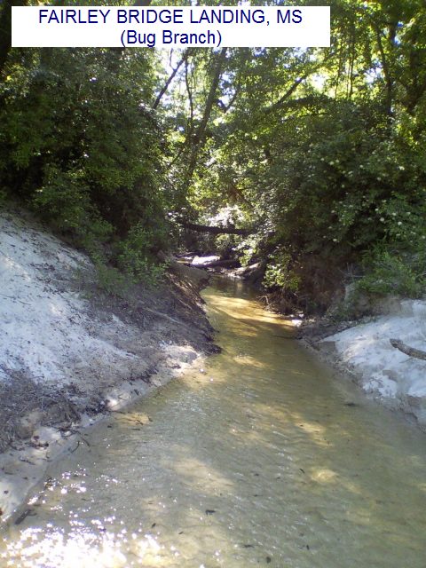
DIRECTIONS | From Hattiesburg, take RT 49 south about 21 miles to Brooklyn, then: (The swimming holes are presented in the downstream direction, which is roughly north to south.) | BIG CREEK LANDING [BIGC]: This from a visitor: "Recreation Area in the De Soto National Forest. This site is the starting point for the Black Creek Float Trip and is also the trailhead for the Black Creek Trail. There is a nearby swimming hole with a rope swing and bluffs. PHOTO , PHOTO , PHOTO , PHOTO , PHOTO , PHOTO , PHOTO . To get there from RT 49, turn west onto Carnes Road just south of the bridge where Black Creek flows under RT 49 at Brooklyn. Go 0.4 miles on Carnes Rd., and turn right onto Rockhill Brooklyn Rd. Continue 3.4 miles until you see a gravel road on the right with a sign for Big Creek Landing. Turn onto this road, take the first right (there is another sign), and follow the road to the parking area. From the parking area, follow the Black Creek Trail (marked with white reflectors) about 0.7 miles downstream. There is a side trail to the right leading down to the swimming hole (31.06576,-89.24469)." LAT, LON lat=31.07058, lon=-89.25439(source: Map) (accuracy: approximate) LINK TO GOOGLE MAP. Very confident. Verified by another. Updated 1/2013. ASHE NURSERY ROAD BRIDGE [ASHE]: This from a visitor: "From Brooklyn, travel east on Main Ave. When the road forks at a cemetery, bear right onto Ashe Nursery Rd. Continue about half a mile until the road crosses over Black Creek. There are parking areas on both sides of the bridge, but the creek and sand bar are more accessible from the south side." PHOTO , PHOTO , PHOTO . LAT, LON lat=31.05286, lon=-89.192505(source: Map) (accuracy: approximate) LINK TO GOOGLE MAP. Very confident. Verified by another. Updated 1/2013. MOODYS LANDING [MOOD]: This from a visitor: "Camping/recreation area in the De Soto National Forest. There is a wide, deep area just behind the picnic tables where the creek makes a V-shaped turn. There is a second swimming hole with a sandbar and rope swing a little ways downstream. PHOTO , PHOTO , PHOTO , PHOTO , PHOTO . Moody�s Landing has picnic tables, campsites, and toilets." "To get there from Brooklyn, travel east on Main Ave. When the road forks at a cemetery, bear left onto Brooklyn Janice Rd. and continue for about 4.7 miles. Moody�s Landing will be on the right. To access the upstream swimming hole, park in the camping/picnic area and find a path through the trees. The creek is just behind the picnic area. To access the downstream swimming hole (with sandbar and rope swing), continue down the dirt road at the southeast corner of the picnic area until it ends in a parking area." The swimming hole is just beyond the parking area. LAT, LON lat=31.050857, lon=-89.117146(source: Map) (accuracy: approximate) LINK TO GOOGLE MAP. Very confident. Verified by another. Updated 1/2013. JANICE LANDING [JANI]: This from a visitor: "Camping/recreation area at the bridge where RT 29 crosses Black Creek. The water appears to be deep enough for swimming at the boat ramp, but there are no sand bars. PHOTO , PHOTO , PHOTO . This site has campsites, picnic tables, and toilets. From the intersection of Janice Brooklyn Rd. and RT 29, travel south on RT 29 for about 2.7 miles. Janice Landing is on the north side of the bridge.� AT, LON lat=30.99424, lon=-89.05088(source: Map) (accuracy: approximate) LINK TO GOOGLE MAP. Very confident. Verified by another. Updated 1/2013. This from a visitor: "Another good swimming hole is downstream of Janice Landing where Beaver Dam creek empties into Black Creek. This swimming hole is about 1.25 miles (by canoe) downstream from Janice Landing. A caveat about this: The Beaver Dam is spring fed and can be pretty damn cold even in August." It may also be possible to hike to the Beaver Dam swimming hole as follows: If you drive south from Janice Landing on RT 29 for about .5 mile, the Black Creek Trail crosses RT 29 here and you may be able to park and hike the trail about .5 mile in the downstream direction to get to the swimming hole (30.98570,-89.04101). Not sure about this hike. Pretty confident. Not verified. Updated 1/2013. CYPRESS CREEK LANDING [CYPR]: This from a visitor: "Camping/recreation area in the De Soto National Forest. The swimming hole here has a sandbar and a rope swing. There is also a bluff about 5-8 feet high that people jump from. PHOTO , PHOTO , PHOTO , PHOTO , PHOTO , PHOTO . On-site facilities include showers, toilets, picnic tables, and campsites with fire pits." To get to Cypress Creek Landing from Janice (at the intersection of RT 29 and RT 301) go south on Snyder Rd for approximately 3.7 miles then go south on FR 305 then right on 305-B to the landing. LAT, LON lat=30.96878, lon=-89.00376(source: Map) (accuracy: Approximate) LINK TO GOOGLE MAP. Very confident. Verified by another. Updated 1/2013. This from a visitor: "Another good swimming hole is downstream of Cypress Creek Landing where Hickory Creek empties into Black Creek and is quite near the Cypress Creek Landing; however, be wary of the Hickory Creek sand bar. I've run into lots of quicksand there. Nothing dangerous, but it will surprise you." There is a canoe launch at Cypress Creek Landing. Canoe downstream about 2 miles to where Hickory Creek enters Black Creek and the swimming hole is here (30.94881,-88.99172)." It may be possible to hike to the Hickory Creek swimming hole as follows: You must approach Cypress Creek Landing driving from the other side (south side) of Black Creek on Melvin Breland Rd. (There is no bridge at Cypress Creek Landing, you have to drive a ways to get to the other side. No detailed road directions given here - see a map). You want to get to this point: 30.94603,-89.01166 on Melvin Breland Rd. (put the lat/lon in your car gps). Here the Black Creek Trail appears to cross Melvin Breland Rd.. If you can park here and hike the trail to the east about 1.5 miles you will come to Black Creek at about where this swimming hole is. Not sure about this hike. Pretty confident. Not verified. Updated 1/2013. FAIRLEY BRIDGE LANDING [FAIR]: This from a visitor: "Camping/recreation area in the De Soto National Forest. There is a swimming hole with a large sand bar just upstream from the picnic area, where Bug Branch (appropriately named, see picture) empties into Black Creek. It felt like there was a current in the deep water, so use caution. PHOTO , PHOTO , PHOTO , PHOTO , PHOTO , PHOTO . The recreation area has campsites, picnic tables, and toilets." "To get there from the intersection of Janice Brooklyn Rd. and RT 29, travel south on RT 29 for about 7.5 miles. Turn left on onto Fairley Bridge Rd. and continue for 6 miles. Turn right onto FS 374 and continue 0.1 miles. You will see a sign for Fairley Bridge Landing; turn left at the sign and follow the road to the picnic/camping area. To access the sand bar, follow the path a short distance upstream from the picnic/camping area." LAT, LON lat=30.92023, lon=-88.972263(source: Map) (accuracy: approximate) LINK TO GOOGLE MAP. Very confident. Verified by another. Updated 1/2013.
CONFIDENCE | Pretty confident |
VERIFIED | No |
DATE UPDATED | 1/2013 | |
|---|
This swimming hole listing is by www.swimmingholes.org
|
TOWNS | BILOXI, GAUTIER, VANCLEAVE | LAT, LON | lat=30.53081, lon=-88.67834(source: Map) (accuracy:approximate) | LINK TO GOOGLE MAP
STATE | MS |
WATER | Bluff Creek |
TYPE | Creek |
DESCRIPTION | This from a visitor:"There is a great place called Bluff Creek in Vancleave, MS. It�s a campground and privately owned. It costs a few bucks to get in but you can do whatever you want. We bring grills and fishing poles. They even allow ATVs. It�s a sure enough redneck Riviera! The swimming hole is a horseshoe bend in the creek with nice white sand. The water is dark but clean. There is a rope swing and the water is deep. Except for the occasional boat passing by it�s natural and peaceful. The campground has a pool and cabins for rent as well." WEB SITE .
|
AREAS | Bluff Creek Campground |
SANCTION | Official |
FEE | Yes |
FACILITIES |
All facilities |
ACTIVITIES |
Swimming |
PHONE | 228.826.3958 |
CAMPING | Camping and cabins at site. You should read the reviews of the cabins and bathrooms here before you decide to stay overnight here. |
BATHING SUITS | Required |
DIRECTIONS | From I 10 east of Biloxi, take Exit 57, then RT 57 north
about 9 miles to Vancleave then turn east (right) on Kenneth Cole Rd. Go a short way then turn right at 4301 Kenneth Cole Rd, Vancleave, MS 39565.
|
CONFIDENCE | Very confident |
VERIFIED | No |
DATE UPDATED | 9/2014 | |
|---|
This swimming hole listing is by www.swimmingholes.org
|
TOWNS | McCOMB | LAT, LON | lat=31.16167, lon=-90.27867(source: DeLorme) (accuracy:approximate) | LINK TO GOOGLE MAP
STATE | MS |
WATER | Bogue Chitto River |
TYPE | River |
DESCRIPTION | Swimming place in river (at own risk). WEB SITE .
|
AREAS | Bogue Chitto Water Park |
SANCTION | Official |
FEE | Yes |
FACILITIES |
Picnic tables, Toilets, Bath house |
ACTIVITIES |
Swimming, Tubing |
PHONE | 601-684-9568 |
CAMPING | Camping at site. |
BATHING SUITS | Required |
DIRECTIONS | From I-55 in McComb, take the RT 98 East (exit 15A) continue east on RT 98 for 12 miles then turn right on to Dogwood Trail at the brown Bogue Chitto Water Park sign. Dogwood Trail ends at the entrance of Bogue Chitto Water Park. | Also, very near here, is the "Canoe and Trails Outpost" which is a commercial river outfitter with camping, tubing, canoeing and river swimming (river swimming at $5.00 for day use in 2007). See WEB SITE for directions.
CONFIDENCE | Pretty confident |
VERIFIED | No |
DATE UPDATED | 10/13/2001 | |
|---|
This swimming hole listing is by www.swimmingholes.org
|
TOWNS | McCOMB, WOODVILLE | LAT, LON | lat=31.07310, lon=-91.51225(source: DeLorme) (accuracy:approximate) | LINK TO GOOGLE MAP
STATE | MS |
WATER | Clark Creek |
TYPE | Creek/Falls |
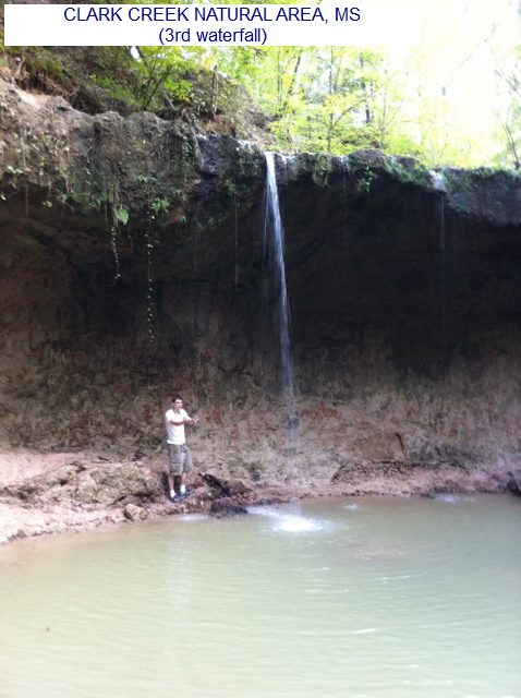
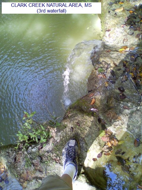
DESCRIPTION | Hiking area in state park with waterfalls (yes, in Mississippi!) and water play possibilities. This from a visitor: "It's definitely the best locale anywhere around here -- folks regularly come from as far as Baton Rouge and New Orleans to hike, bike and swim. However, the best way to do it (in my opinion) is to leave the trail (which basically follows the creek) and slip and slide all the way down the creek itself. It's located in Wilkinson Co. at the most south-westerly point in the state of Mississippi." | "Some sites say it's at "Pond, MS" but all Pond, MS is anymore is the old Pond Store (built 125+ years ago, kind of a general store cum museum with the old post office still intact inside the store and the sleeping quarters for the family that runs it -- fifth generation, I believe -- still in the back of the building). Woodville is the county seat and the only real town in the county. Pond and the park are about 20 miles south-west of Woodville." WIKIPEDIA . See this TRAIL MAP for the locations of waterfalls. There are pretty deep pools at the bottom of the waterfall numbered "1st" PHOTO 1st FALL and "3rd" PHOTO 3rd FALL , PHOTO 3rd FALL. We know that none of the waterfalls on the "Primitive Trail" have deep pools at the bottom. Don't know about the others on the main trail.
AREAS | Clark Creek State Natural Area |
SANCTION | Unofficial |
FEE | Unknown |
FACILITIES |
Unknown |
ACTIVITIES |
Swimming, Hiking |
PHONE | Unknown |
CAMPING | No camping at site. |
BATHING SUITS | Customary |
DIRECTIONS | From Woodville (southwest corner of the state) take RT 24 west a short way to just outside of town then take RT 122 (Pinckneyville Rd) west about 15 miles to Pond (the Old Pond Store). Continue onto Fort Adams Pond Rd. a short way past Pond to the Clark Creek State Natural Area. |
CONFIDENCE | Very confident |
VERIFIED | By another |
DATE UPDATED | 1/2013 | |
|---|
This swimming hole listing is by www.swimmingholes.org
|
TOWNS | NATCHEZ, BROOKHAVEN | LAT, LON | lat=31.425148, lon=-90.985165(source: DeLorme) (accuracy:approximate) | LINK TO GOOGLE MAP
STATE | MS |
WATER | Clear Spring |
TYPE | Spring-fed lake |
DESCRIPTION | Official swimming beach at National Forest lake and campground. WEB SITE . | This description from a fan:� To pass on the love, here's an unbelievably great one for you to add. It's a spring fed lake, with a trail around it, out in the middle of nowhere, run by the national park service. NO power boats, and there's a "deep end" with ropes you can go hang on all day and nobody will tell you a thing, plus a wooden pier to leap off of."
AREAS | Homochitto N.F.. |
SANCTION | Official |
FEE | Yes |
FACILITIES |
All facilities |
ACTIVITIES |
Swimming |
PHONE | Unknown |
CAMPING | Developed N.F. camping at site. |
BATHING SUITS | Required |
DIRECTIONS | From Natchez, take RT 84 east 32 miles then (at 5 miles west of Meadville) turn south (right) on Clear Springs Road (County Road 104), go 4 miles to the recreation area entrance. |
CONFIDENCE | Very confident |
VERIFIED | No |
DATE UPDATED | 3/15/2008 | |
|---|
This swimming hole listing is by www.swimmingholes.org
|
TOWNS | MERIDIAN | LAT, LON | lat=32.22889, lon=-88.82153(source: DeLorme) (accuracy: exact) | LINK TO GOOGLE MAP
STATE | MS |
WATER | Chunky Creek |
TYPE | Creek |
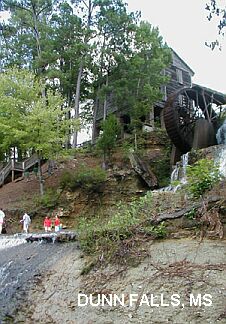
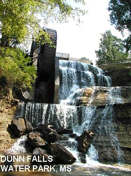
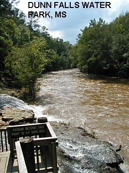
DESCRIPTION | (Photos above and the following description were provided by New Southern View Magazine.) "On the Chunky River there is a 65-foot water fall created in the mid 1850's by John Dunn, an Irish immigrant, to power a grist mill. The falls, created by diverting a stream that flowed 70 yards from a bluff, cascades over the craggy bluff only to be tamed by the calm, quiet Chunky. The crystal clear river offers fishing, canoeing and swimming. A short walk removes visitors from even a nod to civilization, as nature trails wind through the woods which are home to wild turkey, deer, squirrels and other wildlife, carrying hikers - eventually - back to the pond. There is one cabin available for rental. Primitive camping sites are available for those who like to rough it. Paddleboats are also available for rental." | You can swim in the creek below the falls (at your own risk). There used to be a swimming area with beach above the river in the mill's holding pond, but no longer as of 2009. You can still slide down into the river from below the mill pond.
AREAS | Dunn Falls Water Park |
SANCTION | Official (in the pool above the mill pond) |
FEE | Yes |
FACILITIES |
Picnic tables, Toilets, Bath house |
ACTIVITIES |
Swimming, Tubing |
PHONE | 601-655-9511 |
CAMPING | Camping at site. |
BATHING SUITS | Required |
DIRECTIONS | From Meridian, take I-59 southwest to exit 142. Take Meehan Savoy Rd. west a short distance then go south (left) on Dunns Falls Rd (crossing I-59 again) and continue to the water park. |
CONFIDENCE | Pretty confident |
VERIFIED | No |
DATE UPDATED | 1/2010 | |
|---|
This swimming hole listing is by www.swimmingholes.org
|
TOWNS | JACKSON, MENDENHALL, D'LO, PINOLA |
STATE | MS |
WATER | Varies - see below |
TYPE | River/Falls |
DESCRIPTION | Two official water parks to swim in rivers near Mendenhall. For details, see DIRECTIONS below. |
AREAS | Water Parks |
SANCTION | Official (no lifeguards) |
FEE | Unknown | FACILITIES |
Porta-Potti, picnic tables, grills |
ACTIVITIES |
Swimming, Sliding |
PHONE | (601) 847-4310 |
CAMPING | No camping at site. |
BATHING SUITS | Required |
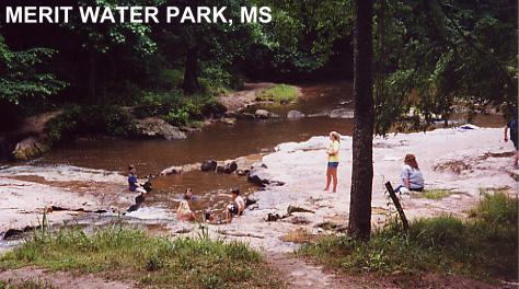
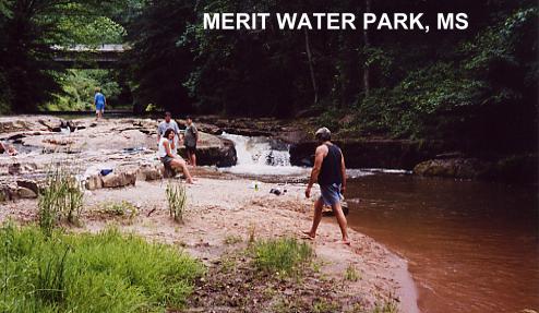
DIRECTIONS | From Jackson, take RT 49 southeast about 28 miles to Mendenhall. Then take RT 13 south into Mendenhall where it meets RT 39, then: | MERIT WATER PARK [MERI]: Rials creek falls onto broad rock formation - forms chutes, pools and jacuzzis. WEB SITE . Popular local swimming hole. Official swimming place, no lifeguards. Porta-Potti, picnic tables, grills. PHOTO , PHOTO . LAT, LON lat=31.92752, lon=-89.91096(source: DeLorme) (accuracy: approximate) LINK TO GOOGLE MAP. To get here from Mendenhall, continue on RT 43 southwest about 1-2 miles and turn/park by the little Country Store and Bait Shop on the right (west) side of the road (before you get to Pinola). Park behind the shop, where there is a hard-to-see sign for Merit Water Park. Very confident. Verified. Updated 1/2010. D LO WATER PARK [DLOW]: Strong River swimming and canoeing park. Also has camping with RV hook ups and cabin rentals. WEB SITE . Bathroom facilities and picnic tables. AT, LON lat=31.97788, lon=-89.89771 (source: DeLorme) (accuracy: approximate) LINK TO GOOGLE MAP. To get here from Mendenhall, turn north onto RT 149 and continue until it crosses the Strong River, just before the town of D'Lo. Very confident. Not verified. Updated 1/2010.
CONFIDENCE | Pretty confident |
VERIFIED | Partially |
DATE UPDATED | 1/2010 | |
|---|
This swimming hole listing is by www.swimmingholes.org
|
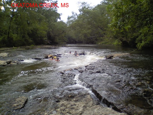
TOWNS | HATTIESBURG, SANFORD, COLLINS, SEMINARY | LAT, LON | lat= 31.55815, lon=-89.50040(source: map) (accuracy:approximate) | LINK TO GOOGLE MAP
STATE | MS |
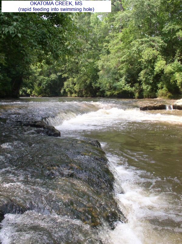
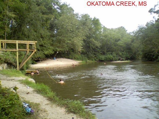
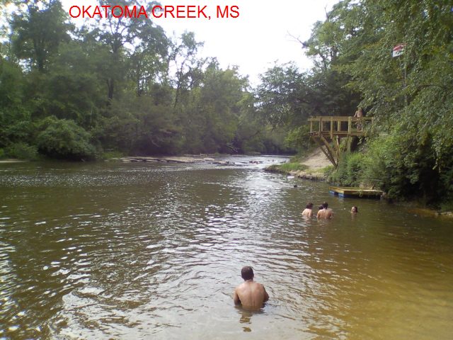
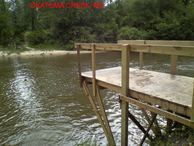
WATER | Okatoma Creek |
TYPE | Creek |
DESCRIPTION | Swimming hole below a rapid with a sand bar on Okatoma Creek. There is also a small bluff that people jump off and it has a wooden pier for people to jump off as well.
|
AREAS | None |
SANCTION | Unofficial |
FEE | No |
FACILITIES |
None at site. Restrooms, showers, changing areas, and canoe/kayak rentals at Seminary Canoe Rental in Seminary and Okatoma Outdoor Post in Sanford. |
ACTIVITIES |
Swimming, jumping, canoeing |
PHONE | None |
CAMPING | Camping and R.V. hookups at Seminary Canoe Rental and Okatoma Outdoor Post. |
BATHING SUITS | Customary |
DIRECTIONS | This from a visitor: "From the junction of Interstate 59 and RT 49 in Hattiesburg, travel approximately 17 miles on RT 49 North. At the intersection of RT 49 and RT 590 in Seminary, turn right onto RT 590 (E Main St) and drive 0.7 miles. In downtown Seminary, turn south (right) on Cherry Ave. and follow it to the end. There is a dirt parking area on the left at the end of the football field. Follow the dirt road down to the creek. (This swimming hole is a short distance downstream of the Main Street bridge in Seminary.) I believe this parking area on the school's property, so you might need to park elsewhere during school days and sporting events. This swimming hole is also part of the Upper Run float trip offered by the Okatoma Outdoor Post, and both float trips offered by Seminary Canoe Rentals." |
CONFIDENCE | Very confident |
VERIFIED | By another |
DATE UPDATED | 1/2013 | |
|---|
This swimming hole listing is by www.swimmingholes.org
|
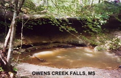
TOWNS | JACKSON, PORT GIBSON | LAT, LON | lat=32.03381, lon=-90.83931(source: DeLorme) (accuracy:general area) | LINK TO GOOGLE MAP
STATE | MS |
WATER | Owens Creek |
TYPE | Falls |
DESCRIPTION | Very scenic spot on the Natchez Trace Parkway with falls into pool below. The pool at the bottom of the falls is usually too shallow for swimming but wading and water play are possible. |
AREAS | Natchez Trace Parkway |
SANCTION | Unofficial |
FEE | None |
FACILITIES |
Unknown |
ACTIVITIES |
Swimming |
PHONE | None |
CAMPING | No camping at site. Camp 10 miles away at the Rocky Springs campground. Cost is free to camp there, but the sites are first come first serve, and no reservations. |
BATHING SUITS | Unknown |
DIRECTIONS | From Jackson, take I-20 west to the Natchez Trace Parkway south. Go about 35 miles on the Parkway, just past the Rocky Springs rest area, to a sign for Owens Creek Falls at mile 52.4. MAP OF AREA (PDF). | As you cross over the falls (stepping stones) there is a path that branches. The path to the left takes you down to the base of the falls with the cave in it. The path that goes straight takes you to the picnic tables.
CONFIDENCE | Very confident |
VERIFIED | Yes |
DATE UPDATED | 11/2010 | |
|---|
This swimming hole listing is by www.swimmingholes.org
|
TOWNS | GULFPORT, WIGGINS, PERKINSTON | LAT, LON | lat=30.79251, lon=-89.13609(source: DeLorme) (accuracy:general area) | LINK TO GOOGLE MAP STATE | MS |
WATER | Red Creek |
TYPE | Creek |
DESCRIPTION | Place where students from Mississippi Gulf Coast Community College swim near Perkinston. |
AREAS | None |
SANCTION | Unofficial |
FEE | No |
FACILITIES |
Unknown |
ACTIVITIES |
Swimming |
PHONE | Unknown |
CAMPING | Unknown |
BATHING SUITS | Unknown |
DIRECTIONS | From Gulfport, take RT 49 north about 30 miles to Perkinston (before Wiggins). Continue a short way north on RT 49 to the Red Creek area. The swimming place (called Perk Beach) is near here - no better directions. |
CONFIDENCE | Uncertain |
VERIFIED | No |
DATE UPDATED | 1/2010 | |
|---|
This swimming hole listing is by www.swimmingholes.org
|
TOWNS | MOBILE, PASCAGOULA, GRAND BAY, FRANKLIN CREEK | LAT, LON | lat= 30.48828, lon=-88.43106(source: map) (accuracy:approximate) | LINK TO GOOGLE MAP STATE | MS |
WATER | Goodes Mill Lake, Franklin Creek, Escatawpa River |
TYPE | Lake/Creek/River |
DESCRIPTION | For many years, the privately owned Presley's Outing Recreation Area has been a center for swimming, boating and tubing on Goodes Mill Lake, Franklin Creek and the Escatawpa River (all connected by water). Sandy beach, canoe/kayak rentals, camping. Family-owned, no alcohol. WEB INFO , MORE WEB INFO |
AREAS | Presley's Outing Recreation Area |
SANCTION | Official |
FEE | Yes, a small fee is charged for day use |
FACILITIES |
All facilities |
ACTIVITIES |
Swimming, canoeing, kayaking, tubing |
PHONE | Unknown |
CAMPING | At site |
BATHING SUITS | Required |
DIRECTIONS | From I 10 about 25 miles west of Mobile (AL) take Exit #75 at Franklin Creek Road and go 1/4 mile north on Franklin Creek Road. Turn right onto Independence Road and go east 1/4 mile. Turn left on Fort's Lake Road and go north 3/4 mile (passing a small convenience store and over a bridge along the way). Turn left/west onto Presley's Outing Road and go 3/4 mile. At the point where Goode's Mill Lake Road and Presley's Outing Road form a fork, bear to the right and follow the signs into Presley's Outing campground. |
CONFIDENCE | Very confident |
VERIFIED | No |
DATE UPDATED | 9/2014 | |
|---|
This swimming hole listing is by www.swimmingholes.org
|
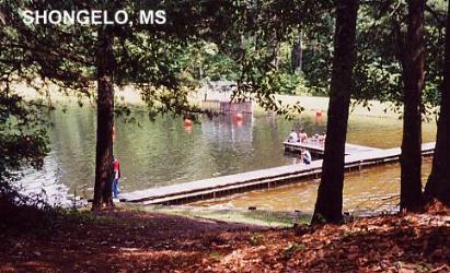
TOWNS | JACKSON, RALEIGH | LAT, LON | lat=32.09867, lon=-89.51275(source: DeLorme) (accuracy: exact) | LINK TO GOOGLE MAP
STATE | MS |
WATER | Unknown |
TYPE | Pond |
DESCRIPTION | Very beautiful, wooded picnic and swimming place in small pond. Dock for diving. |
AREAS | Bienville N. F. |
SANCTION | Official |
FEE | None |
FACILITIES |
Toilets, Picnic tables |
ACTIVITIES |
Swimming, Jumping, Diving |
PHONE | None |
CAMPING | Camping at site. |
BATHING SUITS | Required |
DIRECTIONS | From Jackson, take I-20 east 10 miles to Brandon then RT 18 southeast 35 miles to Raleigh. From Raleigh, go north about 3 miles on RT 35 (into the Bienville N. F.) where you will see signs for Shongelo recreation area. |
CONFIDENCE | Very confident |
VERIFIED | Yes |
DATE UPDATED | 10/13/2001 | |
|---|
This swimming hole listing is by www.swimmingholes.org
|
TOWNS | JACKSON, PUCKETT | LAT, LON | lat=32.06334, lon=-89.74700(source: DeLorme) (accuracy:approximate) area) | LINK TO GOOGLE MAP STATE | MS |
WATER | Strong River |
TYPE | River |
DESCRIPTION | Swimming place in the Strong River, very little information on this place. |
AREAS | None |
SANCTION | Unofficial |
FEE | No |
FACILITIES |
Unknown |
ACTIVITIES |
Swimming |
PHONE | Unknown |
CAMPING | Unknown |
BATHING SUITS | Unknown |
DIRECTIONS | From I-20 near Jackson, go east on I-20 to Brandon then south on RT 18 to Puckett. From Puckett, continue south on RT 18 about 2 miles to the bridge over the Strong River. The swimming hole is near here. No better directions. |
CONFIDENCE | Very uncertain |
VERIFIED | No |
DATE UPDATED | 1/2010 | |
|---|
This swimming hole listing is by www.swimmingholes.org
|
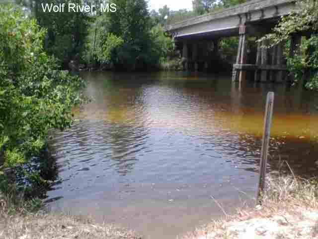
TOWNS | GULFPORT, LONG BEACH | LAT, LON | lat=30.3932, lon=-89.206259(source: DeLorme) (accuracy:general area) | LINK TO GOOGLE MAP STATE | MS |
WATER | Wolf River |
TYPE | River |
DESCRIPTION | Swimming and tubing places in the Wolf River, sandy beaches, some tubing rental places. This from a visitor in 2011:" There's not much of a riverbank or area to hang out right off the river, but plenty of space in the water. The river level is pretty low too, so it's nice cause you can just sit on the sandbanks inside the river and its only like 2 feet deep. The ladder up the bridge structure is a huge plus. You can almost walk across the river. Quite nice. It looks like 1000 ft up river there is a nicer sand bank. A small spot to hang next to water, but bring blankets and chairs to sit down because it is prickly. Waist high water at most points with sand banks to walk on throughout the river. There is a ladder that you can climb to hang out on the bridge structure too!"
|
AREAS | None |
SANCTION | Unofficial |
FEE | No |
FACILITIES |
Unknown |
ACTIVITIES |
Swimming, tubing |
PHONE | Unknown |
CAMPING | Unknown |
BATHING SUITS | Unknown |
DIRECTIONS | From I-10 near Gulfport, take Exit 28, go south on Red Creek Rd, then go about a mile and take a left on 28th/Bells Ferry Rd. After about half a mile, you hit the bridge over the river, park on the east side of the bridge and walk down to water. There are other swimming and tubing places south of here off of Red Creek Rd. |
CONFIDENCE | Very confident |
VERIFIED | By another |
DATE UPDATED | 5/2011 | |
|---|
HOME